The Minnie Life

A year of Adventures in Our Minnie Winnie RV

  • Blog
  • About
  • Places
  • Images
  • Subscribe
Fading light in Hope Valley

Fading light in Hope Valley

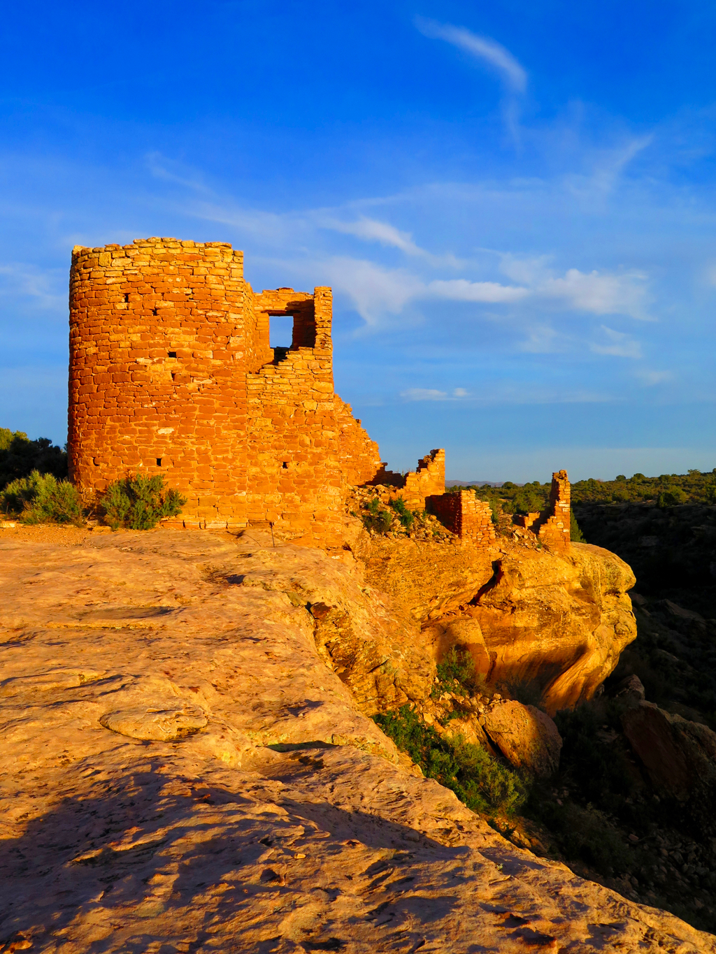
Creeping Toward Stationary

July 05, 2017 by Elizabeth Spengler

We were down to our last week on the road and there was a major heatwave in the west. As we descended from the comparatively cool mountains of Great Basin, the shimmering heat was evident on the highway. Normally we’d have headed to higher elevations and cooler territory, but our friends Erin and Ashley had been plotting for months to surprise our friend Katie in Las Vegas. It had been years since we were all together and we were super excited to see them. Not so exciting were the temperatures—117 for highs & 95 for lows, every day we were supposed to be there. 

I’m possibly the only person on the planet who loves that kind of heat. I love to run and hike and bask, all with a giant grin on my face, while Lisa melts and kvetches and searches for shade. We thought it might be a bit dangerous to dispersed camp in this level of heat, so we checked out some Nevada state parks as we poked our way toward Vegas. First up was Echo Canyon, which had a weedy reservoir better for fishing and birding than swimming, plus shade, lots of shade. As we were hiking there in the cool early morning, we saw an odd sight in the water, a giant brown creature doing the butterfly heading toward two fisherman on shore. Turned out it was a juvenile osprey; somehow it had crashed in the water and couldn't get back in the air. The osprey swam to shore and pulled itself up on the bank. Fortunately, the fishermen turned out to be the camp hosts so they were able to call the rangers for help. We don’t know what happened from there, but we hope the little fella was ok.

The next day, as the temperature crept past 105 at Cathedral Gorge State Park, Lisa broke down and paid to plug in and run our AC for only the 3rd time this year. I sat outside with my people, the collared lizards, enjoying the baking sun.

As evening fell and the desert began to cool, people finally emerged from their RVs, and we met a nice lesbian couple out walking their dogs. As we were chatting they thankfully gave us a critical piece of information: we couldn’t run our AC off of a standard house outlet. It would trip the house circuits and our fuses. We had planned to plug in at Katie and David’s house, but now that was not going to work. With little time left before we hit the road to Las Vegas, we began feverishly working on plan b.

Thankfully we’ve been through Vegas enough this year to know where to go. A quick call to the Oasis RV Park, where we’ve dumped our tanks repeatedly, and we had a place to park the Minnie with the appropriate electrical outlet to run her AC.  

Katie was shocked when we rang her doorbell that morning, and even more shocked when Erin and Ashley showed up that night. Despite the heat it was a great weekend with dear friends, full of laughter and good meals. We all cried when we parted last Sunday but we are already plotting a gathering in Carp this fall. 

As we drove north, bound for California, it hit us that we were really going back to stationary life. We still had a few days before our return to the Bay to tie up loose ends and we were going to make the most of it. We’d envisioned doing a bunch of long hikes in the eastern Sierras that we’d bypassed a year ago. Alas, California’s wet winter is still wreaking havoc here. Almost every trail and campground, was still closed due to flooding creeks or snow. 

The folks at the Forest Service offices were really helpful in showing us what was open, and we cobbled together groups of short hikes around Lee Vining and Mono Lake. It was amazing to see creeks and waterfalls that were mere trickles last year, or nonexistent, raging past with dangerous force. And the green, we haven’t seen California green like this in years! 

Our last two nights in the wild found us dispersed camped in Hope Valley. This was where we spent our first night on the road a year ago, and even though every trailhead here is still closed due to snow, we thought it a fitting place to wind down our time. Deer wandered past the Minnie, and the West Fork of the Carson River raced by behind our campsite. The wind in the pines, a brilliant waxing crescent moon and clouds of hungry mosquitos capped our days here. 

As we drove down from the mountains, bound for a whirlwind few days in the Bay, we had such a profound sense of gratitude for this place and every other wild place that has been our home this year. 

IMG_2930.jpg
Flooded Silver Lake
Flooded Silver Lake
Mono Lake from Panum Crater
Bodie State Historic Park
IMG_3072.jpg
IMG_3065.jpg
IMG_3108.jpg
July 05, 2017 /Elizabeth Spengler
Comment
A pause on the scramble down from the Wheeler Peak Summit

A pause on the scramble down from the Wheeler Peak Summit

The Summit

June 25, 2017 by Elizabeth Spengler

Our cell service has been dicey the last two weeks so we are a bit behind on chronicling our adventures. A bit over a week ago, we returned to Great Basin National Park. This was not in the plan, but then again, the plan evolves on a pretty regular basis. While we were hiking and enjoying time in Bryce Canyon National Park, Alanna asked me where we should go next. I thought about it for a bit, and then said “Let’s go back to Great Basin. I want to try Wheeler Peak again.” This was the 13,063 foot peak that Alanna summited in just the second week of our trip. I was unable to make it to the top, you may recall. I became lightheaded and was simply worn out as we got above the tree line. Yes, I have asthma and that played a role, but the real reason that I did not reach the summit with her last year is that I wasn’t in good enough shape to make such a climb. It’s 3,000+ feet of vertical, most of which happens in the last two miles. 

On our second day in GBNP, we did a shorter hike—a little over six miles with 1700 feet of elevation gain to get our hiking legs moving again. We had spent two days of that week at the Ford dealer in Mesquite, Nevada getting our AC fixed, so we needed a nice hike and a good night of sleep before heading back to Wheeler. The next day, we got up early and drove the ten miles to the trailhead, climbing a few thousand feet from our campground to the 10,000 foot starting point. The hike up is beautiful, passing through aspen groves and pine forests, gorgeous green meadows, past views of alpine lakes, always with the peak in view. I didn’t look up much for the first few miles. I just put one foot in front of the other, happy to have another chance, happy to feel so much better in my body, and happy to have a clear and relatively warm day to make the push. 

We encountered a new twist to the hike this year: snow! Down in the tree line we crossed over a number of snowbanks, slipping and sliding a bit, but nothing too treacherous, then we hit the scree field and the switchbacks that lead above tree line to the rocky summit. Alanna pointed out to me later that I stopped constantly during that portion of the hike last year. Winded and tired and cranky. This year, I stopped once or twice to catch my breath as the air got thinner, but I just kept walking. We took a break with a few others before beginning the final climb up the steepest portion of the trail. A gentleman who was on his way down warned us that the trail ahead was snow covered and that we would need to climb a nearly vertical boulder/scree field to “earn” the summit. Uh-oh, we both thought. 

When we reached that point, we were both scared and nervous as it looked dangerous and difficult, but we went for it. I’m a scrambler, and going slow in order to find a safe route up meant that my asthma was a non-issue on this difficult portion. Ironic, I thought. Next thing you know, Alanna is telling me to head left in order to reach the true summit. I’d made it to the top! I was just about to start crying like a baby, but a bunch of folks were close on our heels, so I held my emotions in check. Another hiker took our photo, with me squinting, of course, and then we sat down to lunch, chatting all the while with what turned out to be a number of other folks who had left SF recently. 

The top was incredible! It felt like I could see forever, and I certainly had a very clear sense of the basin and range topography stretching before us for hundreds of miles. After about thirty glorious minutes on top, we headed down, literally crab-walking down the boulder field. It was really, really tough, and we did it. We did it, Alanna and me, we did it together, and I know that I could not have done it without her. Not a chance. 

I’m really proud of my accomplishment, and I am really glad that we circled back to Great Basin NP. It’s a special park that seems to be getting busier from what the rangers tell us. The campgrounds were full each night and we saw a good many people on the ample trails available.

So, that Friday was a big day. Summit day! Saturday, June 17 was a big day as well—we celebrated nine years of legal marriage (thank you Gavin Newson!) and our friend Amy drove to GBNP from Salt Lake City to hang out for the night. After a short hike through the bristlecone pines, Alanna cooked scrumptious chicken tacos for dinner and we sat around the campfire for hours catching up. As the Milky Way began to appear above the tree line, we finally headed to bed. On Sunday, the Minnie got a break and Amy drove us all out to the Serviceberry Trailhead for a stunning three-mile hike. We all stopped frequently to take in the beauty. 

As of Monday June 19, we’ve been on the road for 365 days! One year of living the Minnie Life, a year that we will never forget, that has been instrumental in allowing us to reset and reassess who we are and what we want. Alanna said on Sunday afternoon that she’s learned life for us has to be about time and experiences. Time together to have great adventures but also to just be present in each other’s lives, which was such a challenge in the hectic life we were leading back in the Bay. Certainly our next life will present challenges in this regard as well, but I think we know more today about how to make the seconds count when we are together and how to devise rich experiences, even for a weekend. 

What an incredible year we have had, what an incredible life we have together. Today more than ever, we recognize and acknowledge the courage it took to walk away a year ago, to have faith that we’d be taken care of and to open ourselves up to a whole new world of possibilities. Gratitude. We are overflowing with it, and there’s just no clear way to express the enormity of gratitude we possess at this exact moment.

Sunrise Bryce Canyon
IMG_1431.jpg
IMG_2208.jpg
Setting moon on the Queen's Garden Trail
Aspen groves of Great Basin NP
View from the Wheeler Summit
June 25, 2017 /Elizabeth Spengler
Comment
Metate Arch

Metate Arch

Washboard Zen

June 12, 2017 by Elizabeth Spengler

We arrived in Bryce Canyon National Park a few days ago, and after where we've been the last two weeks, it feels a bit like Penn Station during rush hour. The Minnie on the other hand, seems to be grateful to be back on paved roads.

After resupplying, hiking a bit and meeting up with an old college buddy and her husband in Moab, we decided to to forego the Memorial Day festivities and head off the grid. Thus, we headed towards the northern section of the San Rafael Swell. Our first stop was the Wedge Overlook, which Utahans call the Little Grand Canyon. Even though there were a number of folks zipping about in trucks and ATVs we found a beautiful spot to camp right on the rim of the canyon. It was a bit noisier than we were hoping, but the next day we were reminded that on Sundays in Utah most places are deserted. Only a handful of cars came past and we spent a lovely day watching the light change on the canyon walls and avoiding the sand tornadoes ripping across the plateau. 

View fullsize San Rafael River Canyon from the Wedge
San Rafael River Canyon from the Wedge
View fullsize IMG_9852.jpg
View fullsize Mini sand tornadoes, very odd
Mini sand tornadoes, very odd

From the Wedge we dropped down into the canyon and found an amazing campsite on the San Rafael River under sheer red cliffs. It was one of the prettiest places we have camped. That afternoon we had a good laugh at the memory of our nervousness during our first big off-road adventure with Yancy last summer. Here we were relishing being completely alone, twenty odd miles from the nearest paved road, with no cell service. How far we have come, and how much we cherish really getting away!

View fullsize Lisa and the Minnie nestled beside the San Rafael River
Lisa and the Minnie nestled beside the San Rafael River

After four nights off the grid, we were happy to return to Capitol Reef NP for a night to dump our tanks, get water and wait out some storms. Plus, we acquired one last strawberry rhubarb pie.

View fullsize Not a night for Utah's dirt roads
Not a night for Utah's dirt roads
View fullsize IMG_0113.jpg

The next morning we crossed Boulder Mountain and dropped down the Burr Trail Road into the Grand Staircase Escalante National Monument. We spent two nights camping in this section of the monument and one grand day hiking in the very southern tip of Capital Reef, which can only be accessed by a dirt road that Burr Trail dumped us on to. 

The day after our hike, we popped into Boulder to check out the farmer's market as we were very much in need of fresh veggies. Alas, it was not meant to be. No farmers showed up! So we pressed on to the Escalante River Trailhead, where we enjoyed an outstanding, though very warm hike to a natural bridge and a small arch. Perhaps the neatest thing we saw was a zig zag pictograph, that stretched across the wall above an old granary. Thankfully, we crisscrossed the Escalante River a number of times, which kept me cool. 

View fullsize Granaries & pictographs
Granaries & pictographs
View fullsize IMG_0312.jpg

Onward we went to Escalante, a super cute and growing small Utah town. We stopped in at the ranger station for the Grand Staircase to find out about dispersed camping and hiking off Hole in the Rock Road. There were several slot canyons and a few other long hikes we were interested in doing, but Hole in the Rock is 50+ miles of awful washboard broken up by deep sand. The Minnie wouldn't make it to most of the trailheads. We were bummed, but set off to do the few things we'd been told we could access. 

The Minnie's max speed on the Hole in the Rock was 10 mph, which meant the twelve mile drive to Devil's Garden took over an hour. There we found the rather fantastic Metate Arch, but not much else. We headed slowly back up the road and camped for the night with the cows near the trailhead to Zebra and Tunnel slot canyons. 

The next morning, we followed the rudimentary and unmarked trail, with the help of GPS, to the entrance to Zebra Canyon. It is a narrow slot canyon with multiple pools to cross. The pools were only waist high, thankfully, but they were stagnant and kind of smelly. I really do not like walking through such murky water, so after the first pool, I turned back. Alanna forged ahead until she came across two dead ravens that were being protected by a third, who freaked out as she tried to scale a tall obstacle. It scared the heck out of her and since there was no way around the angry raven she turned back. We learned later that the two dead birds were probably fledglings from a nest on the rim, and that the third may have been another sibling. 

Once we were done at Zebra, we headed to Tunnel Canyon, a much shorter slot, and really interesting. Again with the stagnant pools though! I sat it out, but it's a short slot so I could talk to Alanna the entire time. She took some cool photos and then we began the trudge back to the Minnie. I say trudge because it was over 90 degrees, our boots were wet and heavy and we were hiking in deep sand most of the way. Needless to say, when the Minnie came into view, we did a little dance. We slowly drove the Minnie back to the start of the road and took much needed showers.

We had resigned ourselves to being done on Hole in the Rock, so the next morning we backtracked to the Escalante River Trailhead. As we were checking out several pictograph panels, we ran into a BLM ranger and chatted for quite some time. He told us about a rarely used hiking route that would get us to Spooky and Peek-a-boo slot canyons, that would be safe for the Minnie!!! Alanna was thrilled so we returned to Hole in the Rock. Twenty plus miles later, at ten miles an hour, we found camping at a corral by a wash leading to the Dry Fork of Coyote Gulch. 

The next day our patience with the slow drive was rewarded with an awesome hike through about a mile of narrows in the Dry Fork. Note, narrows are not as skinny as slot canyons, you can touch both walls but you don’t have to shimmy through sideways. We dumped out near the entrance to Peek-a-Boo, the most popular slot canyon in the Grand Staircase. We have not seen this many people on a trail in a very, very long time. I was, unfortunately, too short to negotiate the last section of the 12 foot sheer climb into the canyon, but I hoisted Alanna up and she set to climbing and shimmying her way up the canyon. 

Once she made her way back down, we set off for Spooky. There is a reason for its name, it's incredibly dark and so skinny in spots that Alanna could barely fit through sideways. They actually warn "big" people to avoid it. I'm claustrophobic, so when the walls started to narrow about 100 yards in, I turned around. I waited in a spot of shade with our packs while Alanna explored. I'm really proud of her--even though she is also nervous about hiking in slot canyons, she has a grand time photographing them. She is also very understanding when I back out, and is glad that I know my limits around murky water and uber narrow spaces. 

On our walk back out the Dry Fork Narrows, Alanna was positively giddy, a chance meeting with a ranger on a random cliff face, had given us an extraordinary and unexpected day. Alanna drove most of the way back to the beginning of Hole in the Rock Road, at ten miles an hour. This is her sweet spot when it comes to driving the Minnie. Alanna can very oddly, in my estimation, find her zen bumping down a washboard road at slow speeds. It makes me a little crazy, but she loves it. Ultimately, just one more reason we make such a great team. 

Arch to crawl through; Peekaboo
Narrows of the Dry Fork of Coyote Gulch
Winding back down Peekaboo
Spooky before it got REALLY narrow
June 12, 2017 /Elizabeth Spengler
Comment
Druid Arch

Druid Arch

Of Boots and Cairns

June 07, 2017 by Elizabeth Spengler

As we started our return hike in Upper Muley Twist Canyon, my right knee started bugging me. It’s a good pain, though, that I have felt twice before. It happens when my hiking boots are shot, and with 450 miles on this pair, they were definitely done. Fortunately, I had another pair ready to go as we anticipated this pain when we were in Moab a month ago. 

Somewhat surprisingly, the hiking on this adventure of ours has taken center stage. I tried for over a decade to get Alanna to like hiking, to no avail. She was much happier running, and found hikes boring and slow. Two years ago, southern Utah finally changed her tune. Still though, when we set out last June we were not expecting hiking to be the central focus of our days, but interesting trails have very much informed our day to day whereabouts. 

At the end of yesterday’s hike, through the Dry Fork of Coyote Gulch to Peekaboo and Spooky slot canyons, our total mileage is 1215, which shocks both of us. At the outset of our adventure neither of us had climbed a mountain, walked more than 8 miles, or taken an unmarked route into a wilderness area, nor were we looking to, but we have now done all of that and more. 

The roads through most parks are pretty, but a little dull, and while the drive-up overlooks are beautiful, they can have the feeling of a circus. The trails though (almost) always lead us to magical and more isolated places.

View fullsize The not so interesting road leading to...
The not so interesting road leading to...
View fullsize The stunning hike in Harris Wash
The stunning hike in Harris Wash

For example, Druid Arch in the Needles district of Canyonlands NP. It stands 450 feet tall, and unlike most arches it looks like it was built by a giant out of massive slabs of stone. We did the short hike to Delicate Arch, that 60 foot tall icon of Utah, the last time we were here. But the cue of tourists waiting to take their selfies underneath Delicate sort of spoiled the view. Druid Arch was way more interesting in our opinion, even though it was a very long walk. The shortest hike to Druid is 11 miles, but we had to take the long way, 15 miles, since the Minnie was too big for the road to the shorter trailhead. We didn't mind though; it was a clear warm day in a beautiful canyon, plus the distance kept the selfie lines at bay. 

When we arrived in the Bisti/De Na Zin Wilderness Area in the fall we were nervous because we had never ventured off of marked trails before. The Bisti, as you may recall, has not one single trail. Since then we have logged hundreds of miles through unmarked wilderness areas and Alanna has gotten quite good with the compass, topo maps and our GPS app. We adore the solitude and appreciate the extra attention required to navigate.

The trails we have traversed not only took us to stunning vistas, but have offered me the opportunity to get in the best shape of my adult life. I have walked off some serious weight and feel a strength in my legs that I have not felt since I was much, much younger. A great benchmark of our progress has been returning to parks we've been in before and easily hiking the trails we once dismissed as way too difficult for us. Hiking has also been meditative as we spend a good deal of time walking silently. I have loved the chance to just to be in nature, listening to chirping birds, watching wildflowers sway in the breeze, wondering who walked these paths before me.

This post, then, is a shoutout to all the folks who maintain hiking trails, volunteer or paid, wherever they may be situated. A few weeks back, when we were miles into a hike to the confluence of the Green and Colorado Rivers, I had a powerful feeling of gratitude for those whose job it is to care for the trails.

Trail maintenance may be as simple as checking signs and clearing brush, or it may be as strenuous and dangerous as hauling a jackhammer 2000 feet up a mountain to fix a narrow trail section damaged over the winter, like we witnessed on Siyeh Pass in Glacier NP. Either way, we appreciate the people who do this work so that we can find our way and continue to enjoy incredible hikes. And we certainly appreciate the parks and monuments that prioritize trail maintenance—not all do, or can, because of limited funding.

I’m a little ahead of myself, though. Before I can thank those who maintain trails today, I need to give the biggest of shoutouts to the CCC, the Civilian Conservation Corps, and President Franklin Delano Roosevelt.  In the depths of the Great Depression the Civilian Conservation Corps built the current infrastructure of many of our parks. The goal of the CCC was to provide jobs, which they certainly did; over three million young men participated in the program in its nine years of existence. They built visitors centers, campgrounds, roads, picnic areas, and trails in over eight hundred sites nationwide and planted nearly three billion trees.  We know their work well, as almost every mile of marked trail we have hiked so far on our trip has been on a trail built by the CCC.  

As our time on the road, and the trail, winds down (we are still shocked that June has arrived!), we plan to make the most of it by seeing as much as we can see and hiking as far as our legs, and our boots, will take us. Part of the next adventure will be learning about hiking in the Santa Barbara/SoCal region, so if you have any thoughts, send us an email please!

June 07, 2017 /Elizabeth Spengler
Comment

A Puddle in the Right Light

May 27, 2017 by Elizabeth Spengler

It’s probably time to talk about the photography… When I took the photo above it was at the end of a ten mile hike and all we wanted to do was get back to the RV. It was just a dirty puddle, some dry leaves, and the wind distorted reflections of some aspens. I took a shot and kept hiking, forgetting all about it until I downloaded the images.  Imagine my surprise when that dirty puddle turned out to be the shot above, one of my favorites this year.

I was initially a rather reluctant participant in the blog. I am a bit of a Luddite and have long eschewed an online presence, but Lisa wanted a writing outlet and I figured it would probably be easier than emailing friends individually. Funny thing is, it’s actually made me a better photographer, so I’m glad we’ve done it. It made me aware of my ruts, like my fondness for funny shaped rocks and bright blue skies, and pushed me to try loads of new things. Many of those new things turned out to be some of my best shots.

I’ve loved taking pictures since I was a kid, and it was even a big part of my job in the various laboratories I worked in back in my science days, albeit on a microscopic scale. The challenge for me is that I have terrible vision and can’t manually focus a camera. However, I adore colour and see the world in pictures, so I am drawn to capture what I see. 

Disclosure 1: I don’t have a fancy camera. Several years back we got ourselves a good quality point and shoot Canon G16. It was supposed to be our camera, but it actually rarely leaves my hands. It has a decent amount of manual control, excellent auto focus and shoots fabulous colour (a must in my world). There have definitely been occasions and places where my 5x lens isn’t quite enough, but I persist and can usually get at least a few interesting shots. Plus, it’s pretty funny to stand with other photographers whose lenses are the size of my arm—they don’t always take me seriously, but that doesn’t stop me. 

Disclosure 2: Editing software is fine, I just don’t use it. Occasionally I’ll need to crop an image, but I try to make all my exposure adjustments in the field with my camera. For me, it’s important to capture what I see in a place in the moment rather than an idealized ‘perfect’ image. 

Disclosure 3: I probably take about ten shots for every one I keep. It’s worth it, though, when I find that one shot that is just magic. 

Disclosure 4: Lisa is the most patient wife EVER. Whenever I ask, she willingly gets up before dawn and drives me to locations and stands in the freezing cold while I take pictures of the sunrise. When she gets too chilly she heads to the Minnie and makes me a cup of coffee. Plus she is always more than happy to stop and wait on a trail when I get distracted by the light on the rocks or an interesting insect.

Suggestions from eleven months of daily photography:

  1. Know where your light is—blue skies turn out best with the sun at your back; rocks can look as if they are glowing when you are shooting into the sun. 
  2. Think outside the so-called ‘golden hours’ of sunset and sunrise. Most of my shots are actually taken midday (usually mid-hike). I like sunrise and sunset but often dinner or our desire to get a few extra winks gets in the way!
  3. Light always changes so even though it is tempting to write off a cloudy day or flat hazy light (I used to do it all the time) you just never know what will happen. In fact, most of the time when I am patient, I’ll get at least a few interesting pics.
  4. Take the time to read your camera manual and learn how to use all of the settings; even the ones you hate initially may be of use someday. 
  5. Take your camera for walks. It’s fun, a good way to try out new techniques, and get a bit of exercise! Even if you know the area well, it will help you notice different things.
  6. Have fun and shoot what you love. If you don’t love what you are shooting it will show. For instance, I don’t love trees, so it’s very rare I get a good picture of a tree. 

It’s been a wonderful year of growth for me as a photographer. The gift of this time has allowed me to spend more time playing with my camera than I could have ever imagined. Studying the shots I have taken, paring down to the handful I like, and talking over my ideas with Lisa has allowed me to push myself in new and unexpected ways. I appreciate the thoughtful and kind feedback I have received from so many of our readers—your joy and amazement is inspirational! 

Two part blog—now it is my turn to talk about the photos and the photographer! Lisa chiming in here to share my thoughts on Alanna’s work. Yes, we bought the camera together at Sammy’s Camera in San Francisco. We recommend this shop as they were incredibly helpful and patient with Alanna’s questions. She’s been documenting our trips for a couple of years and with ease and grace, I relinquished my rights to the camera a few years ago. I just can’t take anything that compares and while Alanna is a patient teacher, I actually get a ton of joy watching her do her thing. I appreciate the shout out above in disclosure #4. I agree! 

It has been wonderful to watch her grow as a photographer this year—to question herself, to puzzle through a challenge, to wonder why something did not turn out, to humbly take in the praise. I love when she surprises herself with a picture that she falls in love with even though she had no idea it would turn out that way when she hit the proverbial trigger. 

Our time away has given Alanna time to reflect on what’s next for her and her art, and given us time to discuss from both the theoretical and practical side of life, what makes the most sense. In addition to photography, Alanna is also a modern quilter. Long hikes and drives and time have led her, and us, to the conclusion that it is time to follow her art, which also means following her heart. So, she’s going to make a go of sharing (and selling) her photos and her quilts with a much wider audience. 

As you may have already realized, many of Alanna’s photos are already available for sale via Fine Art America. Yes, this is where I am going to proudly support and promote Alanna’s business! She spent a good deal of time researching various outlets and liked FAA the best. A number of folks have ordered prints as well as notecards and given us excellent feedback on the quality. I actually ordered some notecards and love them! 

Note that Alanna is not putting every pic published on the blog on the FAA site—we don’t have the data for that, and she’s trying to be selective. If you an image from the blog that you want her to put up on FAA, just send us an email and Alanna will take care of it as soon as we have internet service. By the way, Alanna is somewhat mortified that I am writing all of this, plugging her business, but I told her that if we don’t share the information, how will they know? Thanks for supporting her throughout this trip and as she transitions into her next career!

IMG_9534.jpg
IMG_9600.jpg

P.S. Always take pictures from the car, while someone else is driving of course. Both of the shots above are from the window of the Minnie. Sure it's nearly impossible to hold the camera still and you'll delete more than you keep, but sometimes you get something amazing!

May 27, 2017 /Elizabeth Spengler
Comment

Oh, the Weather!

May 20, 2017 by Elizabeth Spengler

We were settling down to sleep when a truck rattled over the bridge at the end of the Sand Island Campground. I noted that it had been 17 days since we had heard a car at night. In our old SF life, noise was a constant, but out here not so much. The desert at night brings a deep silence that we have grown to love. 

We marveled at that fact as the Minnie sheltered us from a night of driving rain. This wasn’t where we’d planned to spend two nights, but the aforementioned storms kept us from dispersed camping in more remote areas nearby. 

As we were getting ready to leave Capitol Reef on Monday, it was still freezing (and snowing) in many parts of Utah, thus heading west to Bryce Canyon would have to wait. But no matter, we had bypassed the Needles section of Canyonlands on our way to meet our friends in Capitol Reef, and we knew of a few hikes that sounded interesting so we decided to circle back. There’s always more to see and do and experience in Utah!

The route we opted to take was Utah 95, which skirts the north end of Lake Powell. It was a drive we hadn’t taken yet and it was stunning. Steep-walled red rock canyons led away in every direction, while golden hued petrified dunes spiraled along the Colorado River. We settled in for the night at a primitive site overlooking the Dirty Devil River and sat for hours watching the light and clouds shifting as a line of storms rolled across the canyon. 

Morning found us hiking out Marinus canyon. It was a pretty hike but between a boulder flipping as I stepped on it and nearly landing on my toes, a snake in the middle of the trail and a tarantula hawk avidly guarding something on the path we needed to cross, it was clearly not our morning, so we turned around early. 

As we stopped for lunch post-hike we discovered that one of our tires was pretty low. We were about 100 miles from the nearest town, but thankfully we were near a ranger station. Fortunately, the kind rangers at Natural Bridges National Monument were happy to help and escorted us to their maintenance area where we were able to fill the tire. 

By this point it was late in the afternoon and pouring rain so our dispersed camping options were dwindling as the roads grew muddy and impassable. Thankfully we found a spot at the base of Comb Ridge, Utah’s third massive monocline, in the Bears Ears National Monument. Bizarrely the storms had completely bypassed this small area so the road in was clear. 

Before dinner I got a bit antsy, and we went out for a short walk down the dirt road. Short turned out to be two hours, as we stumbled upon an overgrown trail that led to five Ancestral Puebloan dwellings tucked on a ledge. Only in this part of Utah can a random evening stroll lead to such an incredible archeological site. 

Surprise! 

Surprise! 

The next day, we watched dark clouds drift in and around the spot where we wanted to hike. We were about a mile out on a dirt road, which isn’t far, but dirt turns to soup in the rain here and we didn’t want the Minnie to get stuck. So we headed to Sand Island just south of Bluff. We’d avoided it in the past because we read that it was a loud campground full of rafters either putting in or taking out of the San Juan. We had two relatively quiet nights, discounting the trucks on the bridge, and it turned out to be more than just a safe rainy day camp. The cliffs there are lined with over a mile of rock art panels dating back to 3000 CE. We saw shapes and forms that we have not run across yet, which was very exciting. Even though we got rained on, it was well worth taking our time to take all of the images in. 

Friday morning we celebrated our 1000th consecutive meal together! Our schedules being what they were in SF, we rarely got to eat together, and we have relished having this time together. Instead of just another bowl of cereal, we decided to go big and popped into the Comb Ridge Bistro in Bluff. We’d heard amazing things about their blue corn pancakes, and Bluff is full of huge signs proclaiming that they are a “Proud gateway to Bears Ears.”  We were eager to find out if the bistro really lived up to the reviews, and we were more than willing to spend some money in this tiny town that boldly proclaims support of the monument. The meal was incredible, and the coffee so good that my body was practically humming for hours afterwards. We plan to eat at this little spot every time come through town, which we hope is often.  

The morning wrapped up with a visit with some Cate School students. Amusingly we were only 20 miles from where Cate’s American Wilderness class was putting in for a five day paddle trip. It was great fun to see the kids—all seniors in their last week of school—head out for an adventure of a lifetime. It was a good reminder for us both that even though this journey is coming to a close, we are headed to a really special place. 

P.S. The public comment period for protecting Bears Ears and 20 other National Monuments throughout the U.S. is open through May 26th (for Bears Ears) and July 10th (for the other 20). The Department of the Interior is attempting to delist these monuments, including a large section of the Grand Canyon, so that they can be opened to uranium mining and oil drilling. If these places matter to you or even if you just enjoy seeing pictures of them, please make your voice heard. 

Wolfman Panel, note the bullet holes. This is why these places need protection.
Comb Ridge
Comb Ridge
Dirty Devil River
Dirty Devil River
Basketmaker II petroglyphs at Sand Island
San Juan River after the storms
IMG_9201.jpg
More of the Wolfman Panel
May 20, 2017 /Elizabeth Spengler
2 Comments
Capitol Reef NP: the Navajo call it the Land of the Sleeping Rainbow

Capitol Reef NP: the Navajo call it the Land of the Sleeping Rainbow

Fifty and Change

May 13, 2017 by Elizabeth Spengler

50 years on this planet. That’s something. Fifty feels good—peaceful and grounded. Then again, I spent nearly the entirety of my 49th year living in a motorhome with my wonderful wife, traveling to the most beautiful places in this country, breathing in the freshest of air, hiking to our hearts’ content, reading voraciously, and living primarily outdoors. I feel like I glided into fifty and that it met me with the warmest of embraces. 

When I left my job and when we left our home, I know there were some, maybe many, who thought we were out of our minds and no doubt wondered if I was having a midlife crisis. I think it was more like a midlife necessity. After all, who walks away in our work, work, work, go get ‘em, achieve, find success, earn, earn, earn American culture? Some. Us. But not many and certainly not nearly enough. 

In my final few weeks at Burke’s, Gale Mosheim, beloved second grade teacher who was retiring after a forty year career at the school, stopped me one day to share her thoughts on my departure. Gale called me wise and courageous. That was huge for me, to have a woman I’d long admired give me that kind of encouragement and support. Gale thought I was so smart to take a year off to spend with Alanna to explore and see the country. She was experiencing health problems at that time, and she said, “You know, Lisa, you just never know. We just assume that we’ll get to retire and do all the things that we want to do, but you just never know.” Those words inspired with me throughout the summer and fall and into the early part of winter. In a way, having Gale endorse my crazy adventure made it all all okay and buoyed my spirit. When Gale died in January, I realized just how prophetic her words to me were that spring day, and that’s when I really knew we’d made the best decision of our lives. It was never a midlife crisis. It was always a midlife necessity. Gale told me so.

So fifty feels good, really good. I feel rooted in my life, spiritually and emotionally, and I feel rooted in my relationship. I remember those days, especially in my teens and twenties, when I was always seeking and looking outward. I was trying to find things to distract me, take me out of myself, allow me to be someone else. I just struggled with me. What a gift, to no longer have that struggle. I get to be me and know that life is good and just the way it’s supposed to be. I love me and my life at fifty, and I’m grateful that I now know to look inward—that any seeking today is about nurturing and nourishing what’s already inside of me.

Alanna and I both wondered from the start where we would be for my big birthday. Since we travel with no plan, we knew it could be just about anywhere, all contingent on weather and wildfires. As we headed into Utah three weeks or so ago, it seemed certain that our celebration would take place somewhere in the southern part of the state. Turns out, we made it to our hands-down favorite National Park in Utah—Capitol Reef! I could not have asked for a more gorgeous or peaceful place to celebrate fifty. 

But wait, the storyline gets better. I was chatting with my friend Anne a few weeks back and mentioned that my birthday was coming up and the next thing you know, she’d rounded up two of my other besties, purchased plane tickets, rented a car and just like that, they rolled into camp on May 7, just in time for a scrumptious Alanna dinner. Around the campfire that night, we laughed and caught up and it felt like we’d never left them. On the 8th, we went for a long and lovely hike, gorged on chips and salsa, went for a drive, then had my birthday dinner—green chile cheeseburgers! Cake’s a little hard to come by out here, so we celebrated with amazing locally made pies, courtesy of the park store. They sang happy birthday, we wore silly hats and took lots of pictures. Paula blew up a pic of my face and put it on little sticks and Tricia had commemorative t-shirts made. On the actual day, May 9, we had brunch and talked and teared up and laughed and took more pictures. When they left, I really cried. The hardest part of leaving SF was leaving our people. To have these amazing women show up for me—leave their families and responsibilities and fly to Utah to celebrate with us, well, it’s the best birthday I’ve ever had. What a way to turn fifty, full of love and friendship, grounded in me and my people. And, I got to wake up on my birthday morning next to my number one person, Alanna, whose warmth and generous spirit and abundant love over the last twelve years have helped make me the woman I am at fifty. 

No one luckier on this planet than me. Gale was right—it was a wise and courageous decision, and the best gift I could have given myself, this midlife necessity.

IMG_0153.jpg
Sunset in the park orchards
IMG_7953.jpg
IMG_8111.jpg
Not a bad place for a snack
Cohab Canyon
Cohab Canyon
The Castle from the Navajo Knobs Trail
IMG_8534.jpg
Driving at sunset
Driving at sunset
May 13, 2017 /Elizabeth Spengler
Comment
Sego Canyon Pictographs, estimated to be between 3000 and 7000 years old

Sego Canyon Pictographs, estimated to be between 3000 and 7000 years old

Water, Wind and Time

May 07, 2017 by Elizabeth Spengler

Five gallons of water per day. That is what we have been living on for the last month. Why you ask? The simple answer is that in southeast Utah water is scarce and in every park we’ve visited, water is trucked in from the closest town, sometimes fifty miles away. What this has meant for us is that in the last month we have had two showers and one bucket bath. We definitely smell, but we’ve been having a grand time! 

Funnily enough, it’s actually water and lots of it that has created this incredible landscapes we’ve been visiting. The soil here is mostly sand and rock so when it rains, especially in the summer monsoons, the water isn’t absorbed, it races off causing flash floods that scour and polish the rocks into crazy forms. Freeze thaw cycles and the ever present wind do the rest, creating arches, cliffs and deep canyons. 

The Island in the Sky district of Canyonlands National Park is set on a mesa and has dizzying vistas into the cliffs and canyons carved by the Green and Colorado rivers. We were lucky enough to snag a campsite in the park—there are only thirteen. On one of our short hikes we overheard a guy say, “I keep hoping there will be an escalator.” The next day, as we descended 1400 feet down a sheer cliff face, I kept laughing at his words. There are definitely no escalators in canyon country! 

Despite the unreal views and epic sunsets, it was freezing and we had snow flurries every day, so after three days it was time to descend to a more reasonable altitude. Moab is not our favorite town. It’s busy and noisy, filled with adrenaline seekers of all kinds, and more revving engines than we’ve heard all year. It is, however, a necessary stop as it is pretty much the only place to restock for hundreds of miles. 

We each bought our fourth pairs of hiking boots, then loaded up our bookshelves and pantry before heading out to the unknown. That night we ended up in Sego Canyon, a BLM site on the National Register of Historic Places. The site contains pictographs and petroglyphs spanning thousands of years. Our favorite were the Barrier Canyon group, which are life-size red figures with horns and headdresses and bug-eyes. We met a BLM archeologist at the site who was out with a group of volunteers assessing graffiti damage. He gave us loads of information on the Native American inhabitants of the region. And we met some folks from the Utah Rock Art Research Association, a rather cool organization that runs regular field trips to rock art sites throughout the west. 

After a brief drive along Interstate 70, we turned south again towards the San Rafael Swell, which is one of Utah’s three massive anticlines. The swell was basically an eighty mile long, thirty mile wide bubble in the earth’s crust, and over time it has been deeply etched with slot canyons. It is not a park or a monument, though it does contain six massive wilderness study areas, that have been languishing for decades, waiting for Congress to “promote” them. It is rugged country with only a couple paved roads. We knew that there was loads of dispersed camping out there, and that was pretty much all we knew. Imagine our surprise when we pulled into a camp spot at the base of Temple Mountain, a purple, green and burgundy cliff crowned with gleaming white rock (think massive Mormon temple). We stayed three nights exploring several slot canyons and hiking 4x4 roads past the remnants of the uranium boom of the 1950’s. It was a stunning and deeply peaceful place. 

We write this post from the lap of luxury in Capitol Reef National Park. For the first time since we left Santa Fe, we have access to water, a dump station AND a trash bin, all within 200 yards of our campsite! All kidding aside, we love this park and plan to spend significant time exploring here.

Storms over Canyonlands NP
What goes down must go back up...
Corona Arch
Corona Arch
A house from the old mining camp beneath Temple Mountain
Little Wild Horse Slot Canyon
IMG_7404.jpg
Goblin Valley State Park
The Minnie is about as clean as we are...
May 07, 2017 /Elizabeth Spengler
Comment

The Oldest and The Youngest

April 28, 2017 by Elizabeth Spengler

Natural Bridges National Monument was Utah’s first National Park Service site, established in 1908. Bear’s Ears National Monument is the most recent addition, established in December of 2016, just a few short, yet controversial months ago. 

We came here to do one specific hike in the Natural Bridges canyon that we hadn’t been able to do the last time we were here because of monsoons. We ended up doing four amazing treks into the wilderness, mostly in the Bear’s Ears Monument.

These are probably Utah’s least showy NPS areas, at least on the surface. The natural bridges are set well down in the canyon and photograph poorly from the overlooks. The deep canyons that criss-cross Bear’s Ears are hidden by massive mesas covered with juniper and pinion forest. You could easily drive right through, clueless to the treasure trove a short, or long, hike away. 

Sipapu is the second largest natural bridge in the world at 204 feet long and 210 feet high, but until you stand beneath it you cannot truly understand its enormity. It and the other two bridges in Natural Bridges NM were carved by streams within a winding canyon of pale sandstone deeply striped by desert varnish. This was the hike we came back to do. We descended three ladders, several staircases and steep slickrock switchbacks to the canyon floor. After checking out Sipapu, we headed down canyon, stopping frequently to marvel at the beauty of the canyon before arriving at Kachina Bridge the youngest of the three spans. Though its massive size made it difficult to photograph, standing beneath it was impressive. 

The Grand Gulch Wilderness Study Area (c’mon Congress designate more actual wilderness out here!) has over a hundred miles of labyrinthian canyons that are mostly explored on long-distance backpacking trips. We opted for several long day hikes suggested by our camp neighbors and the rangers at the Kane Gulch Ranger Station.

Why Bear’s Ears National Monument? A number of reasons. On our 25 miles of hiking there, we saw eight remarkable Ancestral Puebloan sites; the monument contains an estimated 200,000. We were especially stunned by the massive amounts of pottery shards, of ample size, at one site in particular. And, we were surprised by rock art in new and different colors at each of the sites we visited.

In a lot of ways not much has changed in the Bears Ears since President Obama made the designation four months ago—cattle are still grazing on the mesas like they have for a century, folks are still driving out the 4x4 tracks to distant trailheads and hiking and backpacking in the canyons. Though the kind folks working at the ranger station did tell us that visitation has more than doubled this spring, so that’s a significant change, both for their workload and the local economy. Clearly, with Bears Ears grabbing headlines, it’s drawing a great deal more interest from folks all over the world.

Why did Obama, as one of his last acts as president, safeguard this land with monument status? First and foremost, it means protection from open pit coal and uranium mining and new oil drilling. Some in the state of Utah, and those who work for big energy, have been eagerly and greedily wanting to get their hands on this land for years and years and years.  By preventing the destruction of this land by big energy, Obama saved the ancestral home of many American Indians. Bear’s Ears was home to over twenty-two Native American tribes, many of whom have been lobbying for the creation of the monument since the 1920’s. Now that the land is a monument, they will have more say over the protection of their sacred sites. 

For us, the privilege to hike deep into these canyons, to sit quietly on the slickrock outside an ancient kiva and gaze back over the canyon floor, to listen to a fledgling raptor’s cry, to honor those who lived on and cherished the land before us, this is why we appreciate our nation’s greatest legacy—its parks and monuments. There’s just no good reason to drill or mine here, none whatsoever, or to rescind its monument status. 

Please come to the Bear’s Ears Monument and see for yourself why this place is special. It is beautiful in photographs but photos alone simply cannot capture the true magnificence of this place. We also encourage you to write to your legislators, especially Secretary of the Interior Zinke, about the importance of protecting our parks and monuments, at this moment they are in more peril than at any other time in the last century.

Sipapu Bridge
Sipapu Bridge
IMG_5728.jpg
Kane Gulch
Kane Gulch
Junction Ruin: Kane Gulch
Pictographs in Turkey Pen Ruin
Desert Water
Desert Water
1000 year-old timbers; North Mule Canyon
Grinding stone used to shape tools
Jailhouse Ruin
Jailhouse Ruin
Pictographs Inside Jailhouse
April 28, 2017 /Elizabeth Spengler
Comment

1000 Miles

April 25, 2017 by Elizabeth Spengler

Yesterday we reached 1000 miles of hiking! Jailhouse Ruin, Bullet Canyon trail: Bear’s Ears National Monument.

April 25, 2017 /Elizabeth Spengler
Comment
Goosenecks of the San Juan; the river goes six miles in just one mile as the crow flies
Twilight looking toward Monument Valley
Cliff rose in full bloom
Dawn in Valley of the Gods; Bear's Ears National Monument
IMG_5303.jpg
Looks like the Grand Canyon but we saw less than 20 people all day
IMG_5539.jpg
Muley Point, Glen Canyon National Recreation Area

Bear's Ears & Muley Point

April 21, 2017 by Elizabeth Spengler

We've been dispersed camping for the last few nights in parts of southeast Utah we didn't get to see the last time because of monsoon storms. We've driven thirty miles of dirt roads the last three days, and had 60+mph winds and pelting sand last night, but this place is so pretty it's worth it.

April 21, 2017 /Elizabeth Spengler
Comment
Sunset at Hovenweep Castle

Sunset at Hovenweep Castle

The Last Campsite

April 19, 2017 by Elizabeth Spengler

The campground full sign was hanging under the entrance sign to Chaco Culture National Historic Park. As we very slowly made our way out the thirteen miles of bone-jarring dirt roads leading to the park, we tried to remain optimistic, but secretly we were both a bit crushed. Chaco is a place I’d been talking about visiting since we bypassed it in September due to threat of rain. 

We knew we were taking a risk since it was mid-afternoon and Chaco’s small campground is mostly reservations. Reservations, though, are not our jam; they take all the fun and spontaneity out of traveling and we wish fewer parks took them. Aside from our time in the Grand Canyon where reservations, are mandatory and our work-related visits to Carpinteria, we have traveled with no reservations for the last ten months. We love the freedom that comes in living without reservations or itineraries. It allows us explore a place more if we love it or leave if we don’t anddetour to places we hear about along the way but never knew existed. 

We were slowly circling the campground still hoping the sign was wrong (which it often is) when Ranger Mitchell pulled up beside us. We were out of luck, no sites left for RVs. Dejected, we headed off to the visitor center to inquire about BLM camping and to get a map of the park so that we could see as much as possible before braving the road out again. 

As we stood at the visitor center desk chatting with the two rangers, Ranger Mitchell suddenly realized that there was one last RV campsite that had not been assigned. Someone who made a five-night reservation, left after one, so it was ours! We were overjoyed—three nights to explore this wonderful park. We felt so darn lucky!

This, though, is not a post solely about our free-wheeling travel ways but about this incredible park. The Chacoan Culture flourished from 850-1250 C.E. and it was the center of the Ancestral Puebloan world. They built their great houses entirely by hand with only stone tools, carrying the trees used for beams from mountains fifty miles away. They were remarkable astronomers, aligning their buildings to mark the solstices and equinoxes and had trade routes stretching north to Colorado and south into Mexico. 

Though It was late in the day after we established camp, we were so thrilled to be there that we set off to explore Pueblo Bonito. Words are hard to find to describe the beauty and precision and engineering of these structures. As we walked about with scant few other visitors, we felt the peace in the canyon and marveled at the beauty. We couldn’t help but compare Chaco to our visit to Taos Pueblo a few days prior. They were built around the same time, so it’s something, to stand in the middle of Chaco after spending time on the Taos Pueblo—to go from a living, vibrant community to ruins and relics.

Our second and third days in Chaco allowed us to hike to areas that were further out, with our longest hike coming in at 8 miles. This hike led us to Peñasco Blanco and along the way, we saw amazing petroglyphs, which included Ancestral Puebloan drawings alongside more recent Navajo ones. The “supernova” pictograph was one reason we wanted to do this hike, and we were not disappointed. Researchers believe this pictograph marks the supernova that was recorded by Chinese and Japanese astronomers in 1054 C.E.. It lit the night sky for over a month and surely would have been visible to the Chacoan people. Though we will never know for sure if this is what these symbols represent, I have to say that it was awfully cool to stand beneath such distinct and long-lasting markings. 

While some in Chaco sites have been excavated by archeologists at various points, others remain untouched, with earthen mounds and rubble the only visible signs of a building. Pottery shards seem to be everywhere, something we haven’t seen in busier Ancestral Puebloan sites. Chaco is a special place, and I am grateful that we were able to spend three days exploring. We debated whether we should stay an extra night, but we opted to move on so that another lucky traveler could stay the last night on the abandoned reservation. Turned out that a gentleman from Quebec who had camped near us in Guadalupe Mountains NP arrived just in time! 

After a few days exploring the Bisti Badlands again, we headed out of New Mexico. Though we were sad to leave this amazing state, we know we will be back again and again. 

For the last few nights, we have been camped at Hovenweep National Monument, another amazing Ancestral Puebloan location, set on the Great Sage Plain near the Four Corners. Once again, we hiked to remarkable ruins, sat to take in breathtaking vistas, and marveled at the engineering genius needed to build multi-story towers atop small uneven boulders. Our last day here was crystal clear and from our lunch spot we could see over a hundred miles in every direction. 

We are excited to be back in Utah, where the seeds for this journey were initially planted. And, we are glad to be able to visit places we haven’t been before as well as return to some of our favorites, like Capital Reef NP. We don’t have any reservations, and we don’t have an itinerary to guide us for these last few months, so who knows where we will be and who knows when we will get there. What we do know is that we’ll end up exactly where we are supposed to be at just the right time. That seems to be the way it works for us. 

Pueblo Bonito, as seen from the canyon rim
Chetro Ketl
Chetro Ketl
Petroglyphs including a Hopi kachina mask
Supernova pictograph
Bisti round 2
Bisti round 2
30ft petrified tree atop a hoodoo
IMG_4513.jpg
Sleeping Ute behind the towers of Hovenweep
IMG_4759.jpg
Holly Castle
Holly Castle
IMG_4931.jpg
Cutthroat Castle
Cutthroat Castle
April 19, 2017 /Elizabeth Spengler
Comment
IMG_2918.jpg

The Many Roads to Taos

April 15, 2017 by Elizabeth Spengler

Dosa was one of our favorite San Francisco restaurants; sadly though, south Indian fare is hard to come by in the rural west. We were much in need of a coconut chutney fix when we cruised into Santa Fe last week, so our first meal was at Paper Dosa. A former chef from our SF fave opened his own version here in New Mexico—what luck! When we dove into the green chile cheese dosa we were sold. 

We were grateful for more time in Santa Fe. The food is fabulous, the art inspiring and the warmth of the people unmatched. Our friends Peter and Antonio were once again wonderful hosts, providing laughter and a much needed electric extension cord when the temps dropped into the low 20’s. Weather and odd winter hours thwarted us from a few activities, but we had amazing meals and a ton of fun playing games with Peter and Antonio by the warmth of the fireplace in their kitchen. One morning we sat for hours simply watching the snow fall.

As we’ve already written about, from Santa Fe we headed to Los Alamos. The next day we scooted higher up the mountains to Valle Caldera National Preserve, another place we bypassed in the fall. Wow! It was stunning and profoundly peaceful. The preserve is a massive volcanic caldera that teems with wildlife and vistas that go on for miles. The streams were flowing through the massive meadow but the surrounding mountains were still covered in snow.

We chatted with the ranger for quite some time, then headed out for a couple of short hikes. The first led us past a prairie dog town and out to a series of ponds. Mountain bluebirds raced about as we walked, and boreal chorus frogs dominated the soundscape. We used our binoculars to scan for the large elk herd that lives in the preserve, but to no avail. Our next hike started with a series of massive footprints, most likely a mountain lion, which was really exciting to see!

From Valles Caldera, we headed towards Taos, on the high road. Our plan was to camp at alake, but that plan failed when we reached the bottom of the steep narrow road to said lake only to find that the campground was under construction. Plan B: Traverse back to the low road and camp along the Rio Grande (again!) in the Orilla Verde section of the Rio Grande Del Norte National Monument. Though our intention was simply to find a place to sleep for the night so we could explore Taos the next day, it turned out we had stumbled onto a total gem—a five dollar campsite at the bottom of the Rio Grande Gorge with fabulous water views and the sound of the river lulling us to sleep. We stayed for four nights. 

Taos rather surprised us. Given that I’d only heard of it in reference to vacationing celebrities, I was expecting it to be snooty and fancy. What we found was a crunchy mountain town with neat architecture and more great art. The adobe buildings, many dating back to the late 1700s, still have character and haven’t been overly restored. We spent a few days poking around, chatting with locals and exploring a real interesting range of art in the galleries. 

Up the road from the town of Taos is Taos Pueblo. For over a thousand years the Red Willow people have lived in the main buildings of Taos Pueblo. Set on a mesa at the base of the Sangre de Cristo mountains, it is the oldest continuously inhabited site in the U.S. The residents of the the north and south buildings of the pueblo still live much as they did a thousand years ago; there is no electricity or running water, instead they collect their water from the creek that divides the village in two and use lanterns and candles for light.  Fires provide heat. 

The residents generously open their village to tours, and we enjoyed walking around meeting pueblo residents and exploring the shops of the town’s artisans. One gentleman showed us around the room that his family inhabited for centuries, telling us stories passed down from generation to generation and pointing out the thousand year old cedar beams that still hold up the ceiling. We talked with another resident artisan who had been a police officer for a dozen years and then decided to return to the pueblo to pursue his art, lead a simpler life, and share the story of his people with visitors. Kindness and generosity abounded with each person we met. 

Ovis canadensis nelsoni. The desert bighorn sheep. After a few busy days of exploring, Sunday was declared a chill day, our only plan was a short hike. We cruised up to the end of the Minnie accessible road and parked. Our trailhead was a half mile farther across the river and up a steep windy dirt road. As we walked along a truck pulled up and the guy inside asked if we were looking for sheep. SHEEP!!! Why no, this was not on our radar, but we love love love bighorn sheep. The guy told us where he had seen them and we set off, happily abandoning our trail hike was in favor of sheep-spotting.

Desert bighorn were once plentiful in the southwest, sadly though they are not an animal that does well with human encroachment. While incredibly adapted to the aridity and temperature fluctuations of the desert, they are highly loyal to the places they were born, making them very susceptible to habitat disruptions. Also, diseases carried by domestic sheep are often fatal to bighorns. In most places the local populations are gone, hence we were thrilled to see 22 sheep happily grazing on the cliffs and down by the river on our drive back to camp. We giggled the rest of the afternoon at our good fortune. Over nine months into our adventure, we still look forward to what surprises lie ahead each day!

Ovis canadensis nelsoni
Valle Grande; Valle Caldera Preserve
Moonrise at the Rio Grande del Norte
Taos Pueblo
Taos Pueblo
Red River meets the Rio Grande
April 15, 2017 /Elizabeth Spengler
Comment
Ground zero
Ground zero
McDonald Ranch House, where the plutonium core was assembled

Proximity and Timing

April 10, 2017 by Elizabeth Spengler

On the first Saturday of April and October the White Sands Missile Range opens the Trinity Site, a National Historic Landmark where the world’s first atomic bomb was detonated on July 16, 1945, to the public. April 1st found us in San Antonio, New Mexico, a mere twelve miles from the entrance to the site. When we realized how close we were, we decided to check it out. We arrived just after 8:30am to a two mile line-up of cars. After showing our IDs at the security checkpoint we drove deep into the base. 

Once we reached the site and parked, we walked with a throng of others about a quarter of a mile to ground zero. Little is left of the original installations that were part of the military camp set up for the Trinity test. Instead, a stone maker denotes ground zero and a replica of Fat Boy was strapped to an 18-wheeler nearby. There was almost a carnival-like atmosphere with books and souvenirs being sold, and people taking smiling selfies with the bomb replica. This really surprised us. We expected a more solemn remembrance of this world changing event, and we kept wondering what had drawn our fellow visitors to the Trinity Site.

A handful of signs told a rather skewed story of the making of the bomb, with the role of the military emphasized and the scientists’ role diminished. Robert Oppenheimer, the head of the Los Alamos National Laboratory where the bomb was developed, was mentioned only once. I was trained as a scientist and have studied the Manhattan Project, and Robert Oppenheimer, so I knew there was much more to the story than was being told at Trinity. 

Nowhere was there a discussion of the changes to global history that began in this place, and nowhere was there a discussion of the human impact of nuclear arms. Estimates vary but around 300,000 people were killed in Hiroshima and Nagasaki from the atomic bombs and their fallout. Throughout the American West, as the United States continued to develop and test nuclear weapons, countless civilians were exposed to nuclear fallout, particularly in Nevada, New Mexico and Utah

The most powerful moment of the day for us came as we drove out of the site. A group of downwinders—people exposed to wind-blown radiation from atomic testing in the western deserts—held signs in silence at the entrance gate. They also placed crosses along the highway to remember those they lost to the nuclear fallout. We were moved by their quiet yet powerful activism. 

The Trinity Site was a prime example of history being skewed by the teller. Everywhere were references to American might and ingenuity, nowhere were reflections on the lasting damage wrought on the planet or its inhabitants. 

We talked nonstop as we got on I-25 and headed north, discussing the various aspects of the project that we both knew as well as positing questions we wanted answered. We knew that many of the scientists who worked on the project were Jewish refugees from Europe, and we also knew that after the war most of the scientists who worked on the Manhattan Project became staunch anti-nuclear advocates, as they understood the danger of what they brought to life. Their opposition was often seen as anti-American and in many cases it greatly hindered their scientific careers.

We skipped Los Alamos in the fall, but now we were curious, especially about the telling of the story, so after three glorious days in Santa Fe with our friends Peter and Antonio, we drove the short distance to Los Alamos to get an understanding of how the Manhattan Project is portrayed in the town that was created for and by the project. 

The Manhattan Project National Historic Park was only established in 2015—seventy years after the bombs that altered the course of US and world history! The collective park also includes sites in Hanford, Washington and Oak Ridge, Tennessee, where various components of the Manhattan Project were carried out. 

The Los Alamos site headquarters is just two small rooms in a building that also houses the town youth center. The ranger on duty was very engaging, the displays were excellent, the maps very helpful and the park movie created important context for why this site is so limited. Most of the buildings and materials related to the Manhattan Project are “behind the fence,” meaning they are in secure areas within the boundaries of the Los Alamos National Laboratory. Thus, if you come to Los Alamos to learn about the Manhattan Project, what you will get is the National Park Service Headquarters; a walking tour around the historic part of town, though few if any buildings are accessible to the public as most are privately owned; and the Bradbury Science Museum. 

The Bradbury Museum was where we finally found the information we’d been seeking, and boy there was a lot of information! Though not a large museum, it was chock full of dense and detailed material. As we read slowly through the exhibits, I felt a bit like I was back at a scientific conference, and with good reason since the museum was actually started by LANL scientists.

They covered everything, from the basics of the project, to the impact of nuclear proliferation on world history, to the safety issues and health impacts of nuclear testing (finally, a mention of the downwinders!) to the current work of LANL. We appreciated that they included photos and bios of some of the workers on the Manhattan Project, including a number of women. Honestly though, what surprised us the most was learning that over 900 nuclear weapons had been tested (some underground), mostly in Nevada, since the Trinity test in the summer of 1945. The US no longer allows these weapons to be tested, which is a great thing, yet, so many innocent civilians were impacted when testing was taking place, impacts which the government has struggled to acknowledge. 

We continue to be amazed by how much learning we are doing on this trip, and by the conversations and thoughts this learning sparks in both of us. Would we be sitting around our living room in San Francisco talking over the pros and cons of nuclear weapons, or analyzing the treatment given to the telling of these stories at specific sites in New Mexico? Clearly, the answer to that question is no. What a gift we have in this year of exploration, not only to learn more about ourselves and each other but to learn more about our nation’s past as well as its present. 

April 10, 2017 /Elizabeth Spengler
Comment
Spring in the Bosque

Spring in the Bosque

105 to Snow

April 02, 2017 by Elizabeth Spengler

Snowflakes… on a day where the forecast didn’t even call for rain it had begun to snow. We simply had to laugh as we huddled in the Minnie in Organ Mountains-Desert Peaks National Monument. Less than a week ago it was almost too hot to move, but spring is fickle, so we simply hunkered down with crosswords and books and sticks rummy. The campground was one of the prettiest we’ve ever stayed in even though we only got to enjoy the view from inside. 

In December we bypassed nearby White Sands National Monument when a winter storm dropped the temperatures below freezing. Visiting these giant gypsum dune fields required a day both without wind, which is harder than one might think, and without bombing practice on the nearby missile range. We got our chance on Monday and scooted over the mountains, arriving just after noon. The sun was blinding on the snowy dunes and most folks were content to sled down the dunes; we set off to hike the Alkali Flat Trail. Trail is a generous descriptor. Really it was a bunch of bright orange sticks meant to keep you from getting wildly lost. No matter, we walked off into the disorienting landscape at high noon and didn’t see but a few others along the way. After about a mile and a half, we decided to turn around. The reflection off of the dunes was giving us both headaches. We’re good hikers that way, knowing when turning around might be the best way forward.  

Night found us camped alongside a lake on Holloman Air Force Base. We haven’t camped on a military installation before, but we felt right at home when we pulled in and saw that our neighbors had set up their spotting scope to birdwatch.  A large flock of american avocets plied the water and the shoreline. The wind arrived soon after we did,  and we could see the sand blowing in the monument from our campsite.  

As we watched the sunset on the Organ Mountains that evening we debated heading up there. We knew it'd be colder, but it was on the way and it looked beautiful. Long a hiking destination for the residents of Las Cruces, President Obama created the Organ Mountains monument in 2014. We found a beautiful site right at the base of the mountains and met a family from SF who were just embarking on their own year long road trip adventure. As we debated setting off on a hike, the clouds rolled in with rain and the aforementioned snow. The next morning we hung out for a while hoping the skies would clear but to no avail, so we headed down the mountain to warmer weather. 

Though we headed into Las Cruces to explore the farmers market, we ended up at COAS books, which for SF friends, is similar to Green Apple. Everything used under the sun! The market was a bust—too early in the season, so north we headed to Hatch, New Mexico, a tiny village with an outsize reputation for green chiles. Our own stash of chiles was running low so we stopped in for a resupply and lunch. Early spring is a sleepy time for the town, but we had a great lunch and enjoyed shopping in the sinus clearing chile stands.

Our final destination in March was the Bosque del Apache NWR. We’d so loved our time there in December and couldn’t wait to come back. The cranes and snow geese have already headed north, so the refuge is a much quieter place, and the slow green of spring was creeping across the landscape. 

Without the loudest residents taking all of our attention, we were able to see things we didn’t notice on our first visit, like how the waterways are lined with native desert willows with their multicolored stems. The refuge has done a ton of work to remove the highly invasive salt cedar trees so prevalent in the southwest and restore the native plant communities. We watched great blue herons and great egrets flush out of the reeds, and listened while unknown birds called from deep within the marsh. We whiled away hours driving and walking the refuge, grateful for the stillness and the beauty. 

As March came to a close, we laughed when we realized we drove over 3,000 miles in thirty-one days! Perhaps we got a bit stir crazy this winter and needed March to shake off the doldrums! Whatever the case, we started at the coast of California, went all the way to the south of Texas and now find ourselves in the northern half of New Mexico. We doubt we will rack up so many miles in April, but who knows since the only plan we have is to wake up tomorrow and see what the day brings! 

White Sands NM
White Sands NM
Aguirre springs campground; Organ Mountains
Post-storm sunset Elephant Butte Lake
April 02, 2017 /Elizabeth Spengler
Comment
The work of Donald Anderson, founder of the Anderson Museum of Contemporary Art

The work of Donald Anderson, founder of the Anderson Museum of Contemporary Art

It's Not About the Aliens

March 29, 2017 by Elizabeth Spengler

Roswell, New Mexico... All I'd ever heard about it was kitschy and revolved around supposed alien sightings. After Lisa dragged me to Wall Drug in South Dakota, I made her promise no more kitsch and no more Americana.  Roswell promised a lot of both, so how did we end up here? Art, specifically the Anderson Museum of Contemporary Art.

While it's usually not in our budget to buy anything, we love to check out galleries and museums as we travel. Unfortunately, our visits to highly touted artsy towns have mostly been disappointing. Just the other day we cruised through Marfa, Texas on our way out of Big Bend. The town was beautiful and we saw a few neat pieces, but mostly it was the same hipsteresque shops you find in SF or Portland. Not our jam. 

Thus, we were highly dubious we'd find anything interesting in Roswell and almost skipped it entirely. Man are we glad we didn't. We cruised into town in search of lunch, green chiles required. Big D's Downtown Dive fit the bill. While not a true dive, the food was awesome and people were so friendly, which was a nice change from our Texas receptions. 

Sated, it was museum time. The town boasts two free museums, The Roswell Museum and Art Center and the aforementioned AMOCA. Both were excellent. The RMAC initially opened as a collaboration between local groups and the WPA in 1935. Its focus is southwestern artists, but the range of work was fantastic, modern to classic and everything in between. We saw loads of great pieces by artists we knew and some we'd never heard of. 

We left completely stoked and cruised up to the AMOCA. Donald Anderson, a local oil magnate, began the Roswell Artist-in-Residence program in 1967, with the goal of providing artists from all over the world with the gift of time to simply create. In 1994, he opened the museum to showcase his collection of work from artists who participated in the RAIR. 

This is not your conventional orderly museum; here pieces hang everywhere.  Many are brilliant, some are a bit wacky, but the place feels like a treasure hunt and we loved it. Interestingly, Anderson himself was actually a brilliant painter. He had an eye for light and colour and created stunning abstract geometric landscapes. Fortunately for us the museum had a number of his pieces on display. He was probably our favorite artist of the day. 

On our way back to camp we stopped at the Bitter Lake National Wildlife Refuge just out of town and we're thrilled to spot a flock of black-necked stilts in one of the ponds. Overall, we've loved our stay in and around Roswell. It's not a town that is highly touted in guidebooks, but it has charming old houses, good food, great art and way less alien shtick than advertised. Sure, it's a touch run down and lacked the overpriced boutiques selling flimsy clothing, but Roswell delivered where so many other places failed, and for that we are grateful.

March 29, 2017 /Elizabeth Spengler
Comment
Paddling upriver in St. Elena Canyon 

Paddling upriver in St. Elena Canyon 

Big Bend

March 26, 2017 by Elizabeth Spengler

Vast, harsh, stark, peaceful, still, lovely. Big Bend National Park is many things, and it can be the opposite of itself in a matter of minutes. We opted out of seeing the park earlier in our travels. It seemed a long way to and a long way from.

A few weeks ago, as we were hiking down Guadalupe Peak, Alanna brought the subject up—should we go to Big Bend? We’re in Texas? As happens when you’ve been together as long as we have, I was thinking the same thing. So we went, and now we are quite glad that we did, even though it was a long way, maybe not so much in mileage though certainly in mindset. Maybe it felt much further than it is simply because we were driving deep into Texas and we just didn't know what to expect. 

The first day of driving was some of the hardest we have done on this trip. Roads made horrible by the constant traffic of giant fracking trucks, infamous west Texas winds capable of blowing us off the road, and tumbleweed after tumbleweed. After a frustrating and hostile encounter with a camp host at Balmorrhea State Park, we slept that night, with one eye open, at one of many roadside picnic areas that allow overnight RV parking. 

Our arrival in Big Bend was an eventful one. We hoped to camp at Chisos Basin, which is up in the mountains since the forecast was calling for 100+ temps down near the river, and there was hiking we wanted to do up that way. That didn’t work out. After we pulled into an empty site, a camp host with a chip on his shoulder came racing around the corner and accused me of stealing reservation tags off the site post. I was baffled; we would never do that—maybe, there are campers out there who would, but we certainly haven’t met them yet. He had no basis for this accusation, yet he continued to be belligerent towards me. It was bizarre and our first bad experience with anyone working or volunteering for the NPS. We reported him to the ranger on duty and then wrote up a feedback form for the superintendent. It’s just not alright for anyone to be treated that way. 

So, off we went to the Rio Grande Village. We found a great spot, and by great I mean ample shade in the no generator section. It was HOT. I won’t belabor the point, but I do want you to know that it was over 105 degrees for the four nights we spent in the park. I melt. Alanna basks. We make it work. 

We did some excellent hikes, early in the morning, and really enjoyed exploring the desert and the mountains and the new Fossil Discovery exhibit. One hike took us along the Rio Grande to a natural hot spring. Alanna jumped right in. I didn’t want to combust, so I sat on the sidelines, enjoying her joy. She cooled off in the Rio Grande and then we hiked back in some seriously warm weather. Maybe we trudged that one more than hiked. 

Birds. This park is famous for the birds that live here or use it as a way station. Over 400 species of birds can be spotted, if you are lucky, in the park at various times of the year. March is a good time! The Vermillion Flycatcher was in abundance. Roadrunners delighted us withtheir insect hunting methods and their startling calls. When we spotted a Pyrrhuloxia, we both shouted “oh, oh, oh!” as we pointed out the window of the Minnie. My moment of glory, though, was spotting and identifying a Golden-fronted Woodpecker. Safe to say I may have officially crossed over into being a birder in that moment. It was exhilarating!

One evening, we hiked to the overlook near the campground to watch the sunset. From this vantage point, it set over Mexico. Sublime. That’s an apt descriptor of the color and peace that radiated from this remarkable daily occurrence. Then I thought to myself, “Seriously. A wall. Here. Why?”

As we hiked the trails adjacent to the river, nearly every day, we kept asking ourselves these questions. How could anyone consider building a wall along this absolutely beautiful part of our country. We’ve read recently that this park is one of the spots they are considering starting this farcical project since the federal government controls the land. No eminent domain necessary. 

Look at Alanna’s incredible photos to decide for yourself—is it worth building a wall, decimating this gorgeous place, so that maybe a few migrants who may cross the border here would be stopped? Clearly, we think it’s a horrible idea. We need wild places to remain wild, so that animals, like theMexican black bear, can freely roam their territory, which is borderless, and so that people, who need and seek wild places for whatever reason, have them at the ready, even if they are miles and miles from anywhere. 

Our stay in Big Bend ended unfortunately, sort of as it began. A fellow traveler from Washington, DC came over to ask us about the weather. In the end of a conversation that covered a lot of benign as well as bizarre territory, he made sure to let us know that, “I’m a christian and I don’t agree with the gay lifestyle.” It was really unfortunate, and quite unsettling. We asked him to leave and then tried to settle in for the evening. 

That night, we had red flag warnings due to the extreme heat and dry conditions and the high winds that kicked up. Tough to get to sleep as it felt like red flags were up for lots of reasons, though I was relieved to be woken up by cooler winds around 1am. We packed up early and hit the road, knowing we had miles to cover, if only in our minds. Even though our trip was bookended by unfortunate encounters with nasty humans, we are glad we went to Big Bend NP. It’s like nothing else we have seen, and we are glad to be witnesses to the necessity of this place, exactly as it is today.

Sunrise on the Chisos Mountains
A ribbon of life in this dry dry place
IMG_2043.jpg
Purple prickly pear in bloom
Torrey yucca in the midday heat
18 in. Ammonite fossil smack dab in the middle of the trail!
Breakfast time for the campground's resident javelinas
A cactus wren serenading our hike
March 26, 2017 /Elizabeth Spengler
Comment

@#$%*&! Spring Break

March 18, 2017 by Elizabeth Spengler

The entire state of Texas lets out for spring break at the same time. The entire state! That’s a lot of families and college kids vying for trails and campsites. When we set off to explore the area near Carlsbad, we had no idea what we were driving into. Now we know—wow! New note to self for future travels: do not go anywhere near Texas when it’s spring break. 

Despite the hordes, we were fortunate to land one of the fourteen RV spaces at Guadalupe Mountains National Park. This park, like so many we’ve visited, has surprised us. The mountains loom over west Texas and are a stunning example of a fossil marine reef. The reef was built during the Permian era, 260-270 million years ago, mostly by algae and sponges. Tectonic forces later lifted the ancient reef thousands of feet above the surrounding Chihuahuan desert. In many of the rocks here you can easily see fossils of myriad marine species, which greatly entertained Alanna on our hikes. 

In total, we will spend five nights here, which is a little longer than we expected, but it’s a beautiful park and we didn’t want to compete for campsites again this week. We watched way too many people who look exhausted and desperate cruising through the campground, willing a free space to appear, at six or seven o’clock at night. So, as we've learned along the way, you adjust and compromise and find ample amounts of gratitude for a small sliver of space. 

Our first day here, we took on the Devil’s Hall trail, which was a good warm-up to the park’s marquee trail up Guadalupe Peak. Though Devil’s Hall did not offer much in terms of elevation gain, it did have interesting geology and lots of rock scrambling. For me, it was also a good warm-up in terms of the heat. On a couple of days, today included, I’ve felt like we’ve been thrown into a furnace as the temperature soars into the high eighties in this dry, dry desert.

On day two of spring break, we headed to Carlsbad Caverns National Park. This was a stop that we’ve debated for a while since we’re NOT cave people. In truth, I’m a bit claustrophobic and the idea of going underground, way underground, freaks me out. We looked at pictures and learned that the caverns are roomy and have artificial lights. The caverns are also a UNESCO World Heritage Site, so it was clear that they are special. After much deliberation, we opted to go. 

We learned from others in the campground that the crowds at Carlsbad were huge and that if we wanted to be sure and get in and not be swarmed by people underground (yikes!), we needed to be there before they opened at 8am. We got an early start which ended up being perfect as we got to experience a west Texas sunrise, an absolutely glorious site to behold. The horizon was a warm and brilliant peach for almost an hour, then suddenly just as we crested a hill, a sliver of dark red sun snuck above the horizon. Within a short stretch of time, the now blinding sun was quickly taking the chill out of the air. 

I was nervous as we waited for the doors to open to head down the path. I was nervous when we got to the natural opening. I was nervous watching the swallows dart in and out of the opening. I was nervous for about the first ten minutes of our walk down, and then as my body and my mind began to acclimate, I calmed down and stayed that way until we were back on top. It’s hard to be in your head in this place—it’s so beautiful and surreal, close to 800 feet below the surface of the earth. Each stalagmite, column and stalactite is unique and interesting, and it’s mind boggling to think that over millennia, they’ve been formed by drops of water. We walked the mile long Big Room path with minimal people and minimal noise. When we were done, we opted for the elevator up—we were both ready to get back above ground! 

Funny thing though, we enjoyed ourselves so much that we signed up for a ranger-led tour of the King’s Palace, the deepest part of the cave, on Sunday. Everything until then was booked solid. Who knows if we’ll ever be back here again, so we figured it best to take advantage now, and while we still have the nerve to go underground!

When we woke up on Thursday it was overcast. I was so happy to see the clouds! Our plan was to participate in the Texas spring-break tradition of climbing to the top of Guadalupe Peak, the highest point in Texas (8,7549ft), and I knew that the clouds would save me. We climbed over 3000 feet on a rugged and rocky trail, 4.2 miles to the top. The wind was whipping at times, which made a few of the narrow and exposed ledges a little treacherous. Nonetheless, I was glad the air was moving and that the clouds were holding back the heat. We crested the peak and were greeted by a brilliant blue sky and views that stretched a hundred miles. After lunch at the top, we headed down, which was in many ways the more challenging part of the hike as there were some steep spots and those same unstable rocks we’d crossed over on the way up! An afternoon flopped in our chairs with books and crosswords was our reward for finishing the hike.

Since its a tradition here, we’ve seen tons of people hitting the trail to the peak. Many amply supplied and seemingly fit, while others head off with little to no water or they appear to be very much out of shape. On our way down, two groups asked us if they were close to the top. It was early afternoon and they were both less than a mile up. We told them they had at least three more hours to go to reach the summit. That evening, we wondered if they were one of the many groups coming down by flashlight, or more likely, the light from their cell phone. It makes us happy to see people out on the trail, but we worry that some folks put themselves and others at risk when they embark on a hike that they are unprepared for, either physically or with regards to supplies. 

Turns out Texas isn’t the only place with a statewide spring break, next week New Mexico is off. We were not looking forward to crowds, so on the way down, we started talking about going further into Texas to Big Bend National Park. After studying maps and talking it over, we’ve decided Big Bend and all points in between are up next! I am very hopeful that one of those points in between offers us some serious Texas barbecue!! I’ll let you know. 

P.S. We finally got around to putting up a list of the places we've been on the website. Its organized by state so check it out and maybe you'll find somewhere you simply must visit this spring/summer. Happy Trails!

Top of Texas!
Top of Texas!
IMG_1405.jpg
Devil's Hall Trail
Devil's Hall Trail
The Boneyard, Carlsbad Caverns
Dawn in west Texas
Dawn in west Texas
IMG_1581.jpg
IMG_1653.jpg
March 18, 2017 /Elizabeth Spengler
Comment
Wildflowers at the base of the Superstition Mountains

Wildflowers at the base of the Superstition Mountains

Spring Has Sprung Us

March 12, 2017 by Elizabeth Spengler

Shaking off our sedentary winter ways, we are back on the road again in adventure seeking mode! It feels good to be on the move, without reservations or specific destinations, just an overabundance of curiosity leading the way. 

It’s spring in the Southwest: wildflowers are blooming, cottonwood trees are leafing out, birds are migrating, mating, and waking us up with lovely songs each morning. Our first stop upon leaving Las Vegas was the Hoover Dam. We considered bypassing it altogether, but figured, why the heck not, when else are we going to check it out? Turns out it is a pretty cool thing to behold with nods to Art Deco 1930s workmanship and a pretty incredible capacity to hold back Lake Mead, the largest reservoir in the U.S. (when its actually full, which it hasn’t been in decades).  

That first night out, we camped at Burro Creek, in Arizona, and enjoyed watching soaring bald eagles and the great blue herons that nest in the cliffs by the creek. The next day found us driving around Phoenix and the greater Phoenix sprawl. Wow. There’s over four million people in the Phoenix area and they are spread far and wide. The majority of the drive that day was spent getting around it all! Though spring training was calling out to me as we passed through Mesa, we needed to find camping, so we kept on going, ending up in the overflow lot at Lost Dutchman State Park in the Superstition Mountains. 

The mountains were captivating, carpeted in wildflowers and other vibrant green plants, and they lured us out for a hike even though it was 80 degrees with no shade in sight. My body is not used to this heat yet, but it makes Alanna positively giddy. That night, coyotes howled on all sides of the Minnie, in very close proximity, and we were thrilled to know that not too far from the massive spreadopolis of Phoenix, wildlife remains. 

Since we were headed southeast, the folks camped next to us at Lost Dutchmen recommended Roper Lake State Park, which is exactly where we found ourselves the next night. The drive to Roper was a gorgeous one, through the superbloom happening on the San Carlos Apache Reservation, golden poppies painted the hillsides and could be seen from miles away. 

At Roper Lake, our status as birders seems to have been solidified. We happily spent the afternoon with our binoculars and spotted vermillion flycatchers, and watched large flocks of yellow-headed blackbirds darting around the campground. Roper also proved to be quite the social place. As we went for our nightly post-dinner stroll around the campground, four older lesbians hailed us and invited us to share their campfire. We loved spending a few hours talking about road life with these veterans—they had plenty of insight and excellent tips. 

Our last stop in Arizona was Chiricahua National Monument. On the Echo Canyon hike, we were awed by the massive rhyolite spires covered in lime green lichens. We were bummed that the campground was full since there were other interesting looking hikes, but we were very glad to find a peaceful spot on down the road at the Indian Bread Rocks BLM area. The Dos Cabezas Mountains Wilderness Area loomed directly behind us, covered in monzogranite boulders reminiscent of Joshua Tree, but without the very loud hipsters. Cardinals, black-throated sparrows and phainopeplas darted through the bushes all afternoon. The nearly full moon was like a spotlight illuminating the Minnie, and we were happy to once again be serenaded by coyotes. 

Now, we are back in New Mexico! As we drove across the state line, we cheered and high-fived! This is a state that we really enjoyed in the fall, though we didn’t get to see as much as we wanted, so we are here to finish the job, and expect to spend three to four weeks exploring all that is New Mexico. Our first stop is City of Rocks State Park just south of Silver City. Great hiking around the park and a funky small town to explore tomorrow—we’re psyched! And, we need to throw a plug in for New Mexico State Parks. They are some of the best we’ve stayed in and at just $10 for a developed site, they are a total bargain.

Hoover Dam and Lake Mead, the white ring is the high water mark from decades ago
Saguaros at Burro Creek
Cottonwoods bedecked with new leaves
Glowing rocks of the Superstitions at sunset
IMG_1163.jpg
Rhyolite spires at Chiricahua National Monument
IMG_1209.jpg
IMG_1293.jpg
Dos Cabezas Wilderness Area
March 12, 2017 /Elizabeth Spengler
Comment

A Trial Run at Home

March 04, 2017 by Elizabeth Spengler

As we pulled into the campground at Carpinteria State Beach a jovial volunteer stuck his head out of the registration booth and said, “Welcome to Seattle, if you squint hard in that direction you may see the Space Needle!” A good laugh ensued but it was actually sort of true; grey drizzle enveloped the costal cypress and we couldn’t see the waves a scant fifty yards away. No matter though, we were simply grateful to be there. 

In spite of the rain and clouds, Carp State Beach is a fun place to camp with the crashing waves and croaking frogs lulling us to sleep each night. Come morning, the seagulls awakened us by crash landing on the roof of the Minnie to squawk and screech and peck at the skylights. 

Though we’ve known since December that we would be moving here in July, it still felt a bit surreal. Lisa had some work to do at Cate this past week, so we had a trial run at being in Carpinteria, our new home.

The couple of times I’ve visited Carp previously it’s been picture perfect SoCal weather but dry as a bone. As we rolled west, introducing the Minnie to LA’s terrifying six-lane freeways for the first time, the hills were a neon green that we haven't seen for years in California and orange poppies dotted the hillsides. 

Despite the drizzle that first afternoon, the ocean lured us out for a walk amongst the debris washed up from the recent storms. Heermann’s gulls and royal terns squawked and squabbled over choice morsels in the debris. The next morning a pod of dolphins and several flocks of brown pelicans followed me as I strolled through the natural tarpits that line the beach near the campground. 

There is a harbor seal rookery in town near the bluffs, and when I reached it on my walk, I was excited to learn that in the last week, the mamas had begun to give birth. As I stood atop the bluffs looking down at these tiny pups, some just a few hours old, I felt fortunate that wildness is a big part of our new town. It’s fair to say that I’ll be spending a fair bit time on this beach whether running or walking or just sitting and soaking in the power and beauty of the Pacific.

While Lisa was working, I spent time checking out the town and restocking our bookshelves at the Friends of the Carpinteria Public Library store, where all the books are just two dollars! Carp has a quilt shop, something SF sadly lacked. When I dropped in to pick up some thread I needed for a project, I was warmly welcomed and was excited to learn that one of the local quilt guilds meets there. These two spots will certainly be regular stops for me once we get settled. 

After I picked Lisa up from work on Friday, we took our chairs and blankets down to the sand to watch the sunset. Sunset here is an event, and despite the cold weather, hundreds of people still congregated on the beach to stroll or sit and watch the day draw to its close. It was the perfect, contemplative way to close the day.

We rented a car this time to spare me the terror of driving the Minnie up and down the steep road to campus. Plus, we knew it would give us a bit more freedom to explore beyond Carpinteria. On Saturday, we headed to the highly recommended Santa Barbara farmer’s market. We stocked up on citrus and Lisa couldn’t help but purchase purple carrots the size of her arm! No purple carrots on the road thus far, needless to say.

The people we’ve met here have been incredibly welcoming. Friends from the school invited us to several dinners over the course of the week, and it was wonderful to share good food and laughter with them. We are looking forward to exploring the restaurant scene more on our arrival   as well as hosting dinners in our home once again. 

Our week here also presented us with a new RV challenge. The Minnie needed the bleeder valve replaced on her propane tank because someone who filled our tank a while back broke the valve—totally annoying. What that meant for us was a delicate dance with the amount of propane we used because we needed an empty tank when we turned up for our appointment on Wednesday. Running the fridge became our priority as we didn’t want to have to resort to ice and coolers, so that meant we couldn’t use hot water or the heater for the better part of the week. Not the worst thing out in the backcountry, but more difficult in civilization where people expect you to have bathed recently, so we resorted to chilly showers in the campground’s facilities. On our way out of town, we made a quick stop in Ventura for the replacement valve. Man are we grateful to have a full propane tank and our heater back!

We are officially back out for our last few months on the road. First stop: Joshua Tree National Park. We scooted through here twice already but haven’t explored as it was still freezing cold. Much as we hoped to like it, JTNP isn’t our favorite park. Finding camping was frustrating, as it’s a bit of a free-for-all and not nearly as well run as in other busy parks we visited, but the rocks and Joshua trees were interesting.  

Presently we in Las Vegas to see our friends here one last time on this epic adventure. The last time we were here we saw that Momofuku had opened a Vegas outpost, but we couldn't get reservations. Last night the four of us went there for an incredible dinner. It was a such treat, the food was brilliant, and we certainly haven't had a meal like that since we left SF. And, the people-watching on the strip on a Friday night was entertaining.  We are keeping our fingers crossed that the weather will start to warm on the Colorado Plateau, because the red rocks are calling.

Blue heron eating a rat, Carp Bluffs
Brown Pelicans
Brown Pelicans
Heermann's gulls
Heermann's gulls
Rincon Beach
Rincon Beach
IMG_0545.jpg
IMG_0619.jpg
IMG_0845.jpg
Cholla garden, JTNP
Cholla garden, JTNP
March 04, 2017 /Elizabeth Spengler
Comment
  • Newer
  • Older

If you'd like to buy prints of any of these images Alanna sells her work here